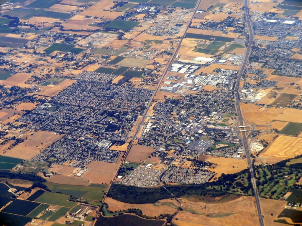
Galt is 6.78 square mile town 23 miles south of Sacramento down Highway 99. Its population is 23,647 (2010 census), zip code 95623, and was incorporated in 1946.
Long time resident and archivist to the town Daniel Tarnasky has written the history of the town….
“Long before the first settlers arrived in California, the Miwok Indians lived and hunted the Great Central valley. In the Galt area, it was the Plains Miwok whose tribes included the Cosumne, Sonolomne, and the Unizumne. The philosophy was to live in harmony with nature and disturb nothing. Little can be found that they left behind, except for a few artistic baskets and personal belongings. In the mid-1700’s, the Spanish came to occupy coastal California, setting up 21 missions. Between 1812-1833, most Miwoks were taken to Mission San Jose by the Spanish – both willing and unwilling. Some returned to work the Mexican rancheros, while others died from diseases the Europeans brought with them.”
“The 1821 Mexican War of Independence gave Mexico the Spanish holdings in California. The Mexican government encouraged the settlement of California by granting large tracts of land. In 1844, the Sanjon de los Moquelumnes land grant was given to Anastasia Chabolla by Manuel Micheltorenia, governor of the Mexican state of California. The grant included 35,508 acres that stretched from the Cosumnes River in the north to the Mokelumne River in the south, and from the Sacramento River in the west to the foothills in the east. Sections of the grant were eventually sold off. Dry Creek Township, where Galt is located, was one of those sections. Two of the early land owners were John McFarland and Dr. Obed Harvey.”
“In 1852, a man called Chism Cooper Fuggitt founded a settlement called Liberty after his hometown in Missouri. Liberty was part of the Chabolla land grant and was located on high ground just south of Dry Creek. Liberty served as a stopping place for drayers (freight haulers) on the way to the motherlode with the supplies brought up river from San Francisco to New Hope Landing (near what is now Thornton). It later became a stagestop between Stockton and Sacramento. Within eight years, Liberty boasted a population of 100 people, with a school, blacksmith, hotel, church, and boarding house. BHut the town of Liberty was short lived, because another man who purchased a large part of the Chabolla grant.”
“In 1869, Dr. Obed Harvey succeeded in getting Western Pacific Railroad (later absorbed into the Central Pacific Railroad) to lay track through his property. Liberty was just a mile southeast, but too far from the railroad to survive. Dr. Harvey decided to build a town along the railroad right-of-way. The law stated anyone could build a town by having the area surveyed and lots sold. The railroad volunteered to lay out the town of 120 acres. The streets had a grid pattern running north and south, east and west. The only stipulation was that there had to be four churches – one on each corner of town.”
Below are the four original churches. Although only three churches ended up on corners as originally agreed, there were four church organizations all of whom hold service today.
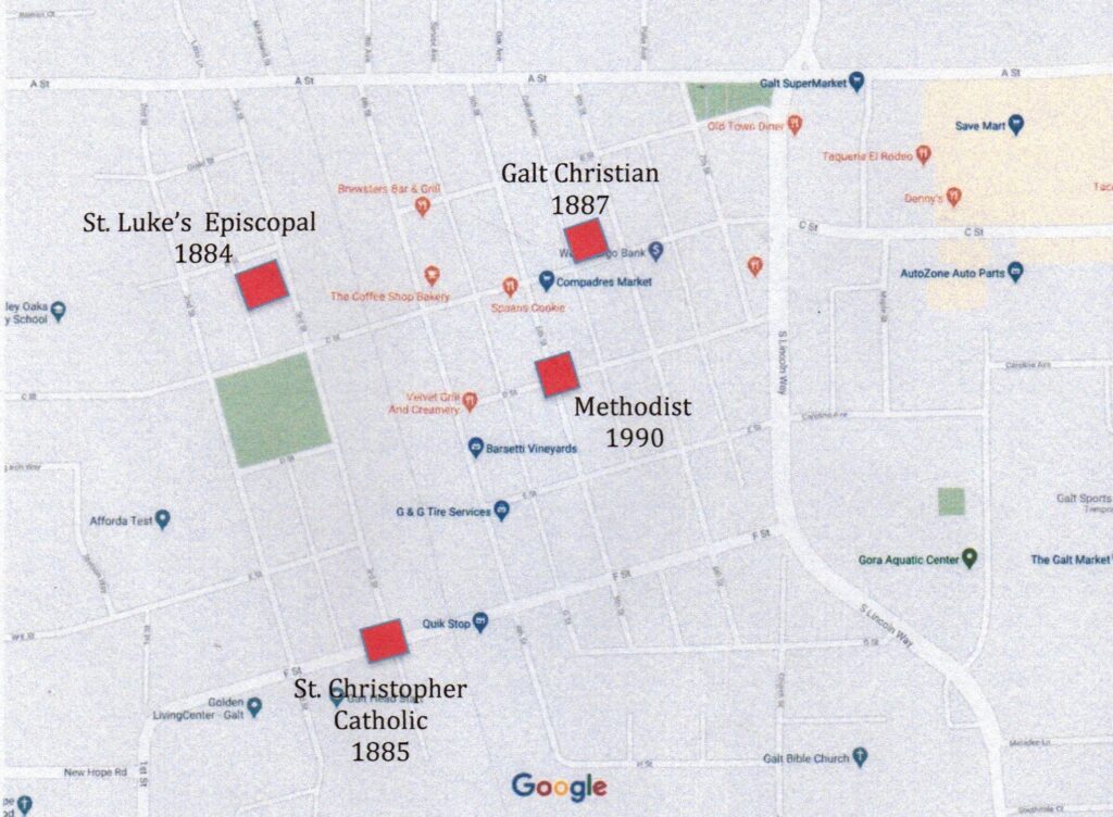
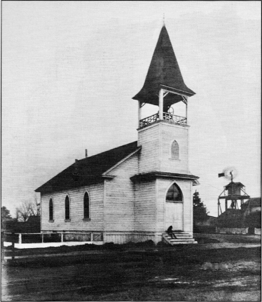
Northeast corner (7th & B Streets) – Galt Christian Church is the oldest building in town because it is one of the original Liberty buildings. Shown here as it originally appeared was built in Liberty in 1857 and moved as a church in Galt around 1887-1888 when it was moved to that corner.
As the church grew, its windows leaked, and woodpeckers nested in the bell tower. In 1925, a basement was added as a meeting hall. William Hobday told how difficult it was to remove dirt without damaging the church structure. The original church was constructed of lumber that came from around Cape Horn. The lumber is still in use as the main body of the church.
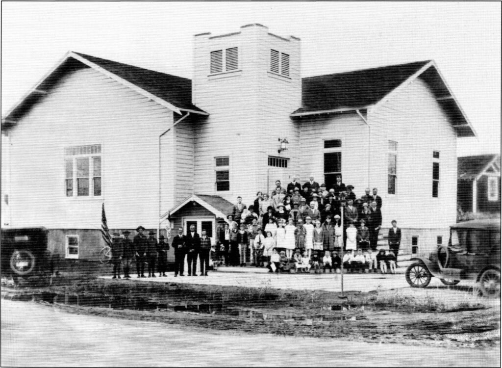
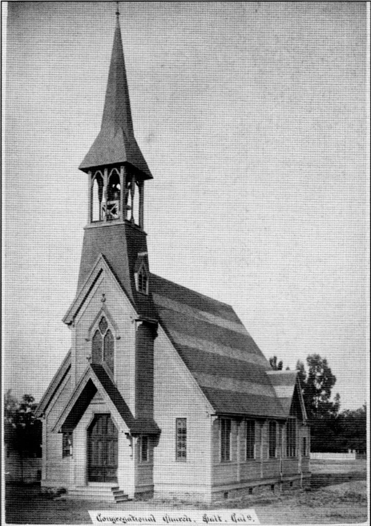
Mid-Town (6th & C Streets) – United Methodist Church was founded when the Hicksville congregation moved to Galt in 1880. They first used a school house for services, but around 1900 erected the building above, the second church in the grid that was agreed upon by the railroad and Dr. Harvey. Though not erected on the fourth corner church required for the grid, it was still accepted as satisfying the requirements. The church was serviced by a Methodist circuit rider who came through Galt on his route to bring the word of God and to “marry and bury.”
Northwest corner (3rd & B Streets) – St. Luke’s Episcopal Church was built in 1884 as a Congressional church. Beginning in 1901 and continuing for a few years, both congregations shared the church. John McFarland and Dr. Obed Harvey were the men behind the efforts to raise funds to build what would be the third church in town.
Southwest corner (3rd & F Streets) – St. Christopher’s Catholic Church cornerstone was layed October 12, 1885 one the anniversary of the discovery of America by Christopher Columbus. It completed the four promised churches , each on a corner of the original town. The church was named after the patron saint of travelers, Saint Christopher. This beautiful church still stands but the congregation has moved to a new church at a different location.
“Another land owner, John McFarland, was given the privilege of naming the new community. He decided on Galt after a Canadian town where he had once lived. It soon became obvious the new town of Galt had the advantage over the small towns nearby. The way of the future lay with the railroad. The town of Liberty faded away.”
Agriculture and the railroad dominated early Galt. The soil rich, and water was only 15 to 20 feet below the surface. Shipping surplus agricultural products brought prosperity. Wheat, barley, cattle, and hogs were money makers. When the lone connection was made by the railroad in 1876, salesman and traders frequented Galt. In 1869, the Galt Hotel was built, and the Devon Exchange Hotel was moved from Liberty and placed on Front (now Fourth) Street. The first store was opened by Whitaker and Ray on the corner of Front and C Streets in a building owned by John McFarland. The small town of Galt was growing quickly.
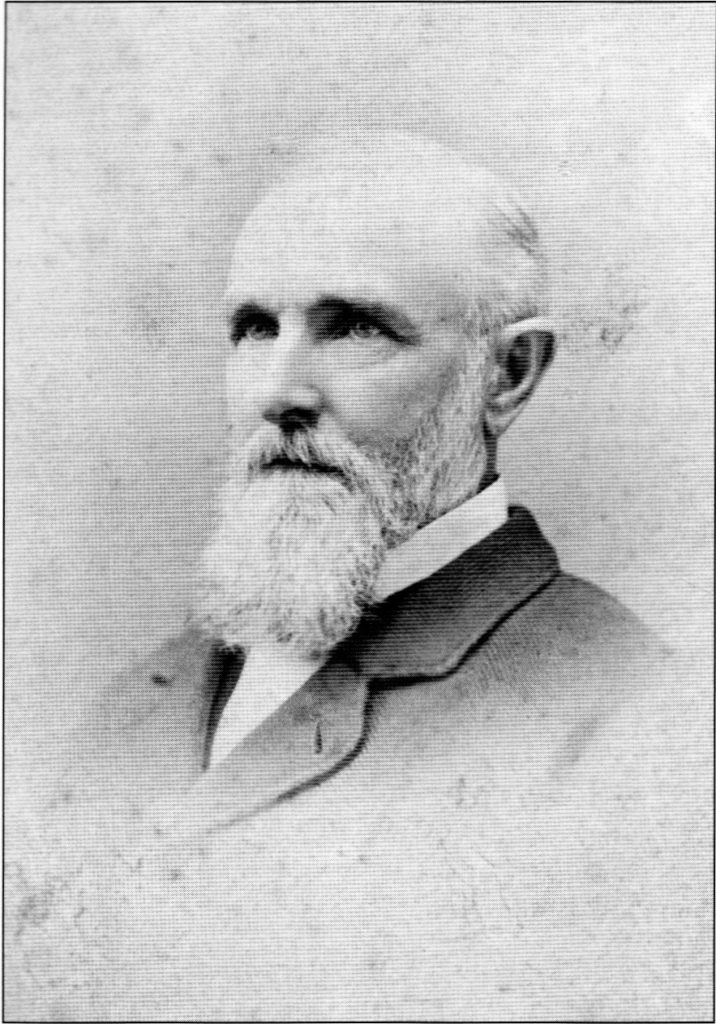
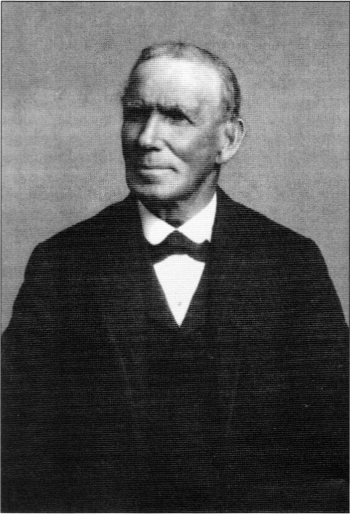
Dr. Obed Harvey – Attended the University of Iowa Medical School. He came to California during the Gold Rush, but instead of mining, he made his fortune in medicine and farming. He was good friends with Charles Crocker, one of the Big Four of the Central Pacific Railroad and both helped layout Galt.
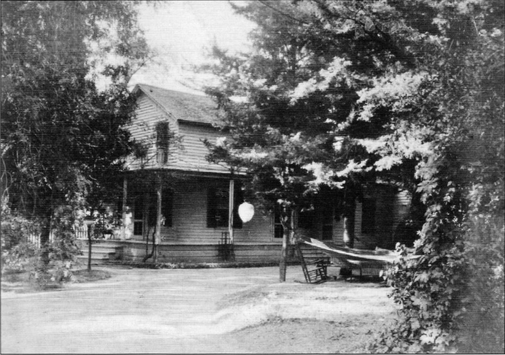
The home of Dr. Harvey was located on 2nd Street between C and E Streets and was behind his medical office.
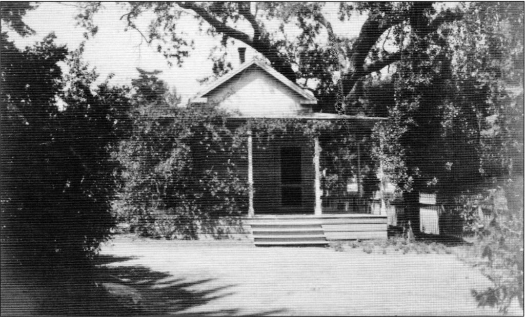
This is the office of Dr. Harvey that was set up on his arrival, but over time he slowly turned over his practice to other physicians and concentrated his time to his 3,500-acre ranch, his interest in building schools and churches, and to serve in state political office.
John McFarland – was born in Starlingshire, Scotland was lured to Placerville by the Gold Rush in 1850. He made his fortune in mining and selling water. In 1857 he traveled to the Sacramento Valley and bought 1,600 acres of farmland northwest of what became Galt.
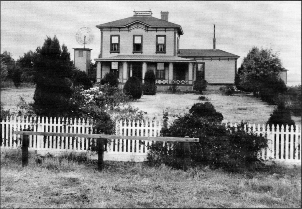
John McFarland built a home on his newly purchased property in 1878. He became a prominent member of the Galt community and because of his carpentry background, helped build or fund the construction of many buildings in Galt.
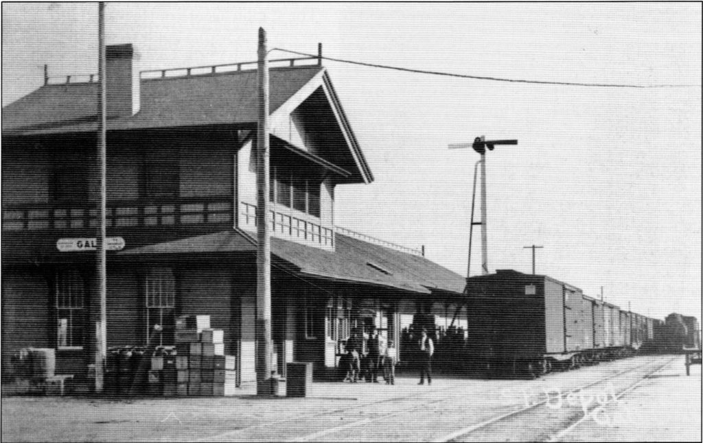
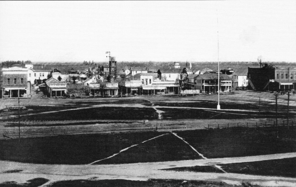
The Galt railroad station became central to the existence of the town of Galt. Many Main Street shops, eateries, and other services on C Street popped up around the building.
The design was Southern Pacific Company design No. 18, a standard blueprint modified for the use the station would receive in that geographic location. The structure was expanded in November 1925.
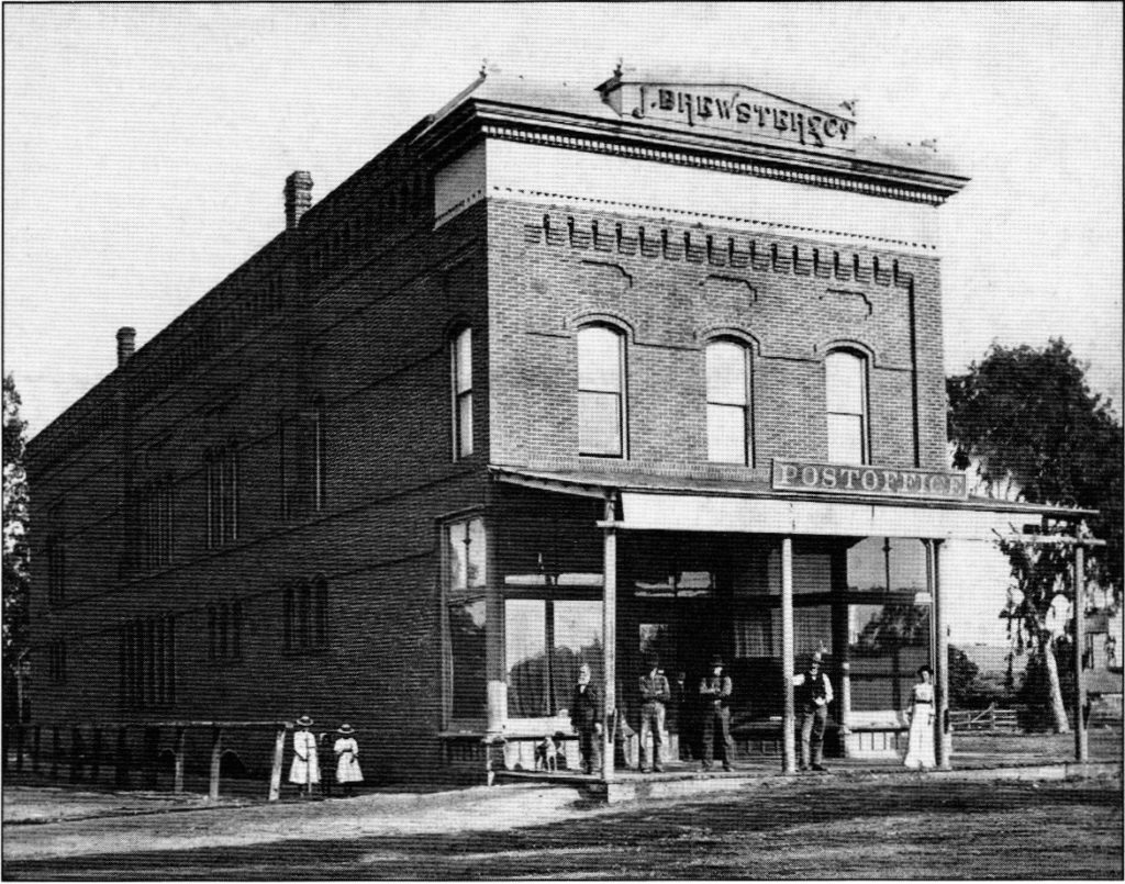
In 1876, John Brewster opened his store on the corner of 4th and B Streets that John McFarland built.
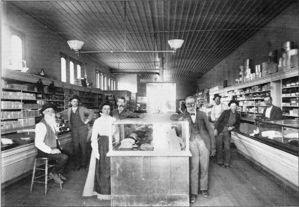
Caroline Brewster on the left and John on the right of the mid-cabinet in their store in 1869 sold general merchandise and bought and sold wheat.
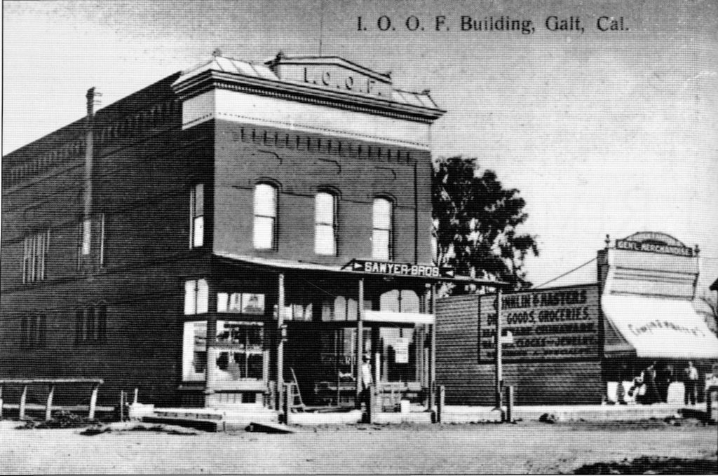
The second use of the McFarland built building now called the I.O.O.F. building. The building changed hands a few times over the years. John and Caroline Brewster, James and Mary Bethel sold the building to Sam Wriston who sold it to the Oddfellows. The Sawyer Brothers general store was on the bottom floor. The building still exists and is presently a restaurant keeping the name by honoring Brewster.
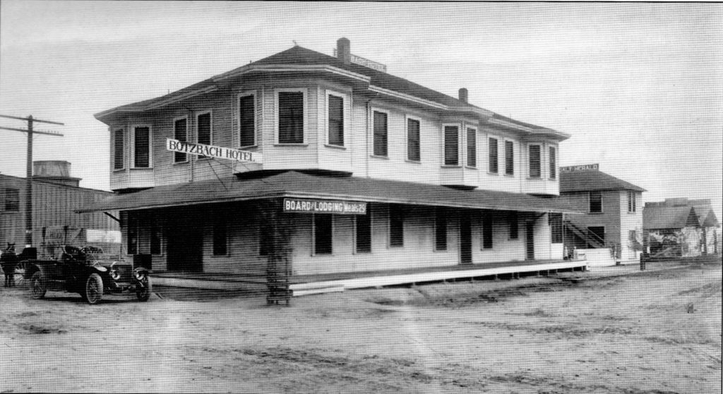
Hotels were some of the first businesses to open in the town. One of the first was the Botzbach Hotel located on 5th and C Streets.
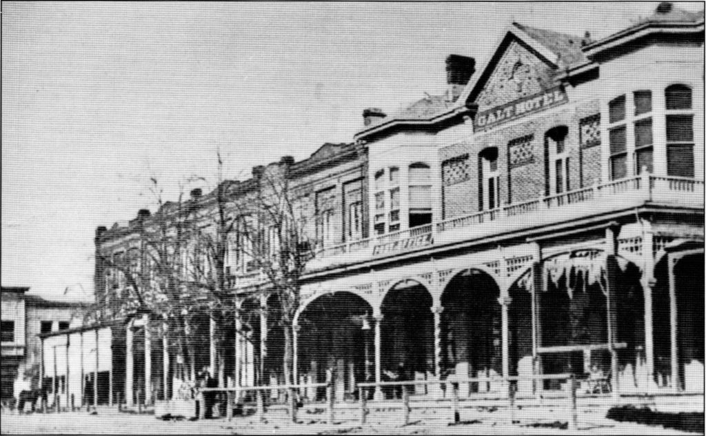
Another of the early hotels in the town was the Galt Hotel located on 4th Street, just south of C Street. Wood structures didn’t last long, so brick became the building material of choice. Notice the hitching posts for horses.

All around the town of Galt were huge ranches adding to the culture of the community. John McFarland’s ranch hands are harvesting what looks like barley. By 1888, wheat planted on California farms approached three million acres’ placing the second in the nation. This is were John McFarland his second fortune.
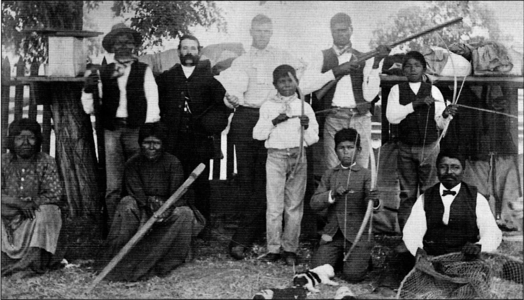
The Plains Miwok Indians worked on John McFarland’s ranch from the early days and were treated fairly. The use of indigent people in the area started with Spanish missionaries along the coast and spread into the interior.
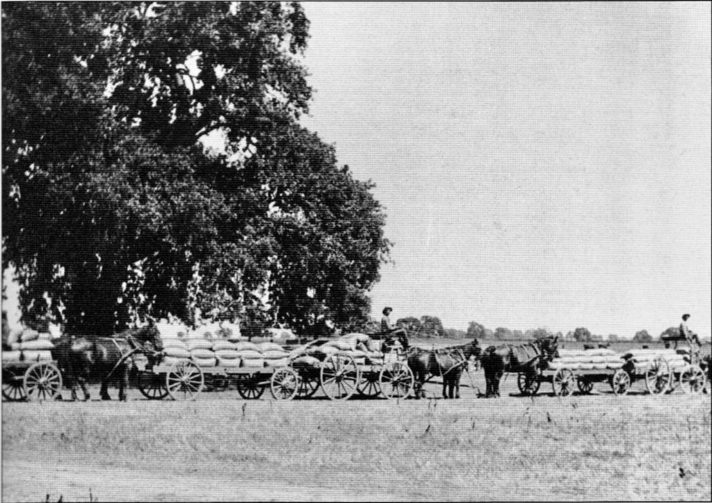
Wagons full of barley are on their way to the railroad station. Soil exhaustion and lower prices, ultimately led to the reduction of wheat farming.
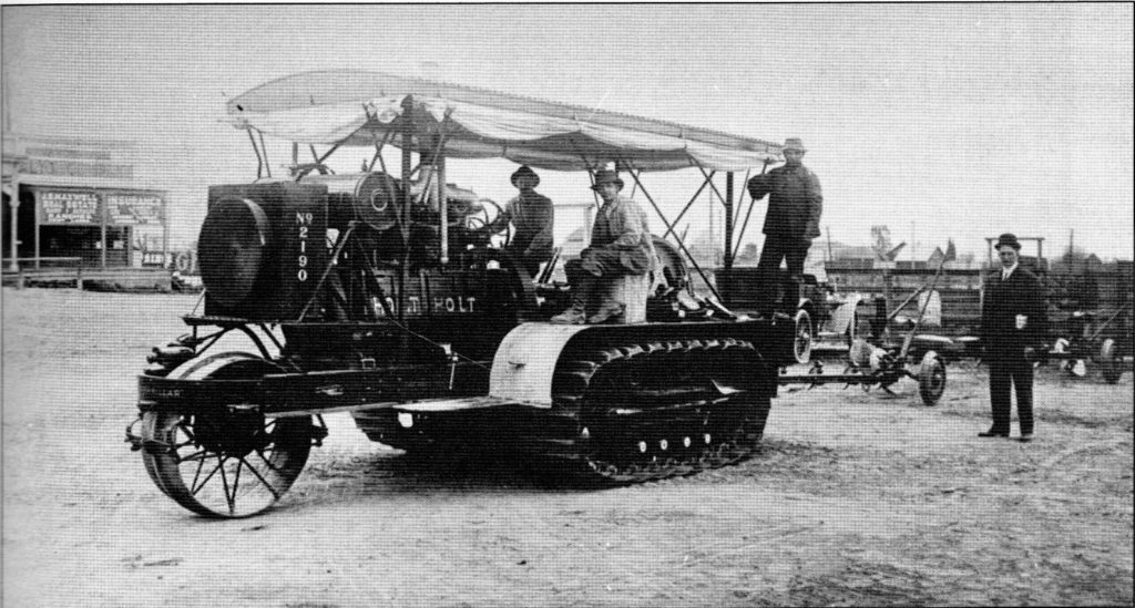
The tractor built by the Benjamin Holt Company in Stockton was truly helpful in the agriculture production. The area became a hot bed of agriculture inventions and at one of the tests, an observer commented, “She crawls along like a caterpillar.” A name was born.
Daniel Tarnasky has written extensively on the history of Galt and it and what little is written here is only a small portion of it. To read the whole story you can obtain a book from Arcadia Publishing in Charleston, South Carolina at www.arcadiapublishing.com (toll free 1-888-313-2665 and email sales@arcadiapublishing.com) for only $21.99. The book ISBN number is 978-1-4671-2479-9.