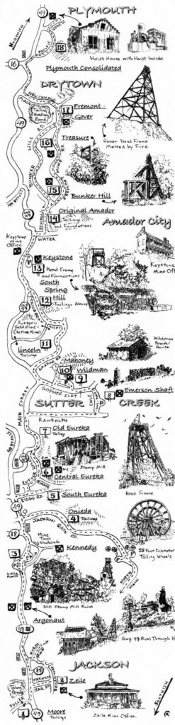
Amador County: Jackson to Plymouth on Highway 49
Gold Mines of Amador – After the gold rush of 1848-1850, miners began to dig into earth and rock to uncover gold imprisoned in quartz rocks’ deep veins. The largest vein was the Mother Lode between Yosemite (Oakhurst) and Georgetown in El Dorado County. The 20-mile stretch from the Mokelumne River to the Cosumnes River was the richest, producing some $160 million in gold between 1851 and 1942. (Current value $5 billion)
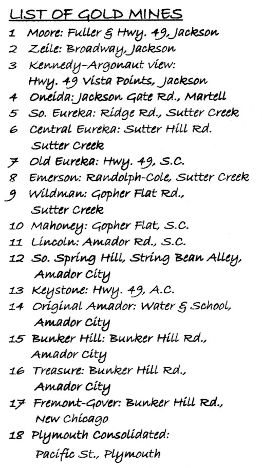
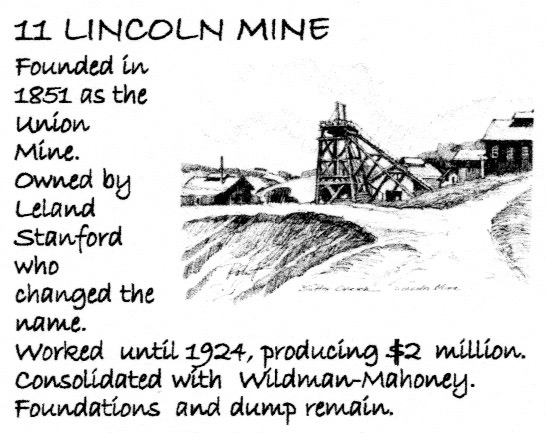
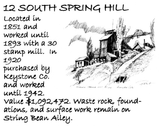
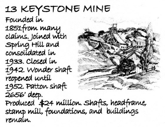
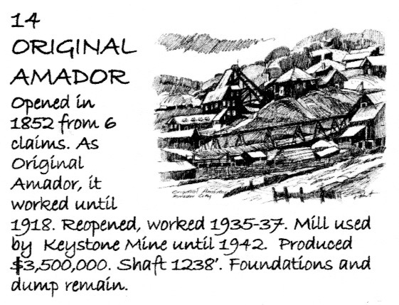
The first hard rock mines were found in Amador City in 1851. The original Minister’s Claim and Spring Hill were soon followed by many others; Lincoln (11), South Spring Hill (12), Keystone (13), Original Amador (14), and Eureka.
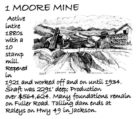
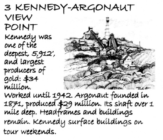
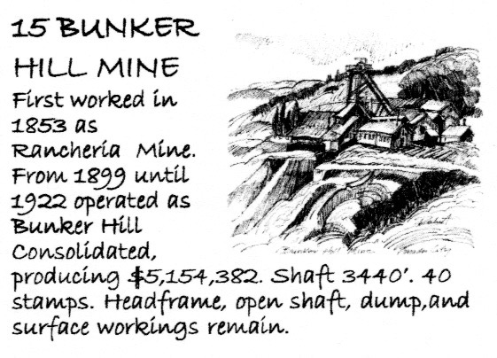
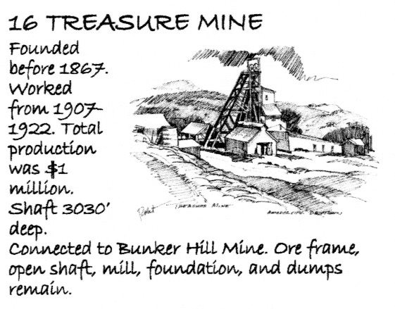
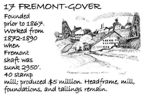
By the 1970’s-80’s Amador County was working 300+ mines. There were some tunnels, but later incline and vehicle shafts reached down a mile into the ground. The Kennedy & Argonaut (3) were close to 6,000 feet deep. Headframes crowned shafts and stamp mills processed and crushed the ore. Some mines were worked by their founders, but most were sold time and again and were improved or went bust. Large American and foreign companies traded in stock and ran the mines from afar.
Workers came from all over the world to look and work for gold. Most were from Europe: Italy, France, Yugoslavia, and Cornwall. Many stayed on to settle towns, marry, and raise families.
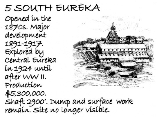
Some mines vanished over the years; others still exist. Of the 400-400 mines, only eight head frames still stand. but many foundations. shafts. and surface works remain.

This map is not to scale. Look for posted signs at each numbered location. The map intersections have been carefully drawn. Most mines 1/4 to 1/2 mile apart. Total trip is about 15 miles. Between Sutter Creek and Drytown and on Sutter Hill Road and Jackson Gate Road, this tour follows the narrow, twisted wagon road originally connecting the mines and towns. Please drive carefully! The articles list ruins and remains surviving at each mine location; the drawings on the map show some of these. Observe the “made landscape”; landforms shaped by tailing piles, holding ponds, canals, and the terraces where the mines and mills once stood. Where access is provided, do get out and explore on foot, but please do not trespass in private property.
For more information about the area, go to: